

Nine numbered long-distance routes, more than a thousand kilometres between them, and eight of the nine finishing inside the province of Belluno. The Alte Vie are the oldest and the most honest way of crossing the Dolomites: on foot, with a pack, sleeping wherever the day ends. In 2026 the most famous of them turns sixty. It is also the busiest, and it may well not be the right one for you.
Search for «alta via dolomites» and you will get the same answer every time: Lago di Braies, the queue for the red rowing boats, Rifugio Lagazuoi at sunset. That is the Alta Via 1, and it deserves every word written about it. The point is that there are nine Alte Vie, that eight of them cross the Belluno Dolomites, and that on some of them — number 3, number 6, number 7 — you will meet more chamois than people in three days of walking.
This guide is here to help you choose. Not to describe one crossing in detail, but to work out which of the nine suits you: by days available, by legs, by kit, by how much solitude you are after.
What an Alta Via actually is
An Alta Via is a multi-day hiking route that links existing mountain huts while staying as high as possible, without dropping to the valley floor. It is not a purpose-built path. It is a line drawn across trails, mule tracks and wartime military roads that were already there, which somebody had the idea of stitching together.
For number 1 that somebody was Piero Rossi (1930-1983), president of the Belluno section of the Italian Alpine Club, climber, writer, and one of the founding campaigners for the Belluno Dolomites National Park, a cause he fought for over twenty years. The route was conceived in the CAI Belluno clubrooms, by Rossi together with Mario Brovelli, with the local CAI sections brought on board.
The sources disagree on the date, and it is only fair to say so: CAI Belluno is celebrating the sixtieth anniversary of the Alta Via 1 in 2026, which points to 1966, the year Rossi passed the first written description to the German climbing journalist Toni Hiebeler. The National Park, on the other hand, gives 1969 — the year the Italian guidebook «Alta Via delle Dolomiti» appeared from Tamari in Bologna. Most likely these are two stages of the same story, the idea and the book, but no source states it outright.
One thing worth knowing before you plan: there are nine numbered Alte Vie, from 1 to 9. The «Alta Via 10» and beyond that circulate online are thematic routes — the Alta Via dei Pastori, the Alta Via dell’Orso, the Traversata del Cadore — fine walks, but outside the official numbering.
The nine Alte Vie at a glance
The figures below are those published by DMO Dolomiti, the tourist board based at the Province of Belluno. Where no institutional source publishes a total ascent, this table leaves the cell empty rather than guessing.
| No. | Name | From → to | Km | Stages | Grade |
|---|---|---|---|---|---|
| 1 | The Classic | Lago di Braies → Belluno | 125 | 12 | E, with EE/EEA finish |
| 2 | Of the Legends | Bressanone/Brixen → Feltre | 180 | 13 | EE |
| 3 | Of the Chamois | Villabassa/Niederdorf → Longarone | 100 | 8 | EE, EEA on the Berti ferrata |
| 4 | Of Grohmann | San Candido/Innichen → Pieve di Cadore | 85 | 6 | EEA |
| 5 | Of Titian | Sesto/Sexten → Pieve di Cadore | 90 | 7 | EEA |
| 6 | Of the Silences | Sappada → Vittorio Veneto | 180 | 11 | EE, grade II and III moves |
| 7 | Of Patéra | Rifugio Dolada → Tambre | 36 | 5 | Mountaineering |
| 8 | Of the Heroes | Feltre → Bassano del Grappa | 63 | 4 | EE, few refuges, little water |
| 9 | The Traverse | Lavina Bianca → Santo Stefano di Cadore | 180 | 14 | Long but not technical |
Alta Via 1: the Classic, and its four quiet stages
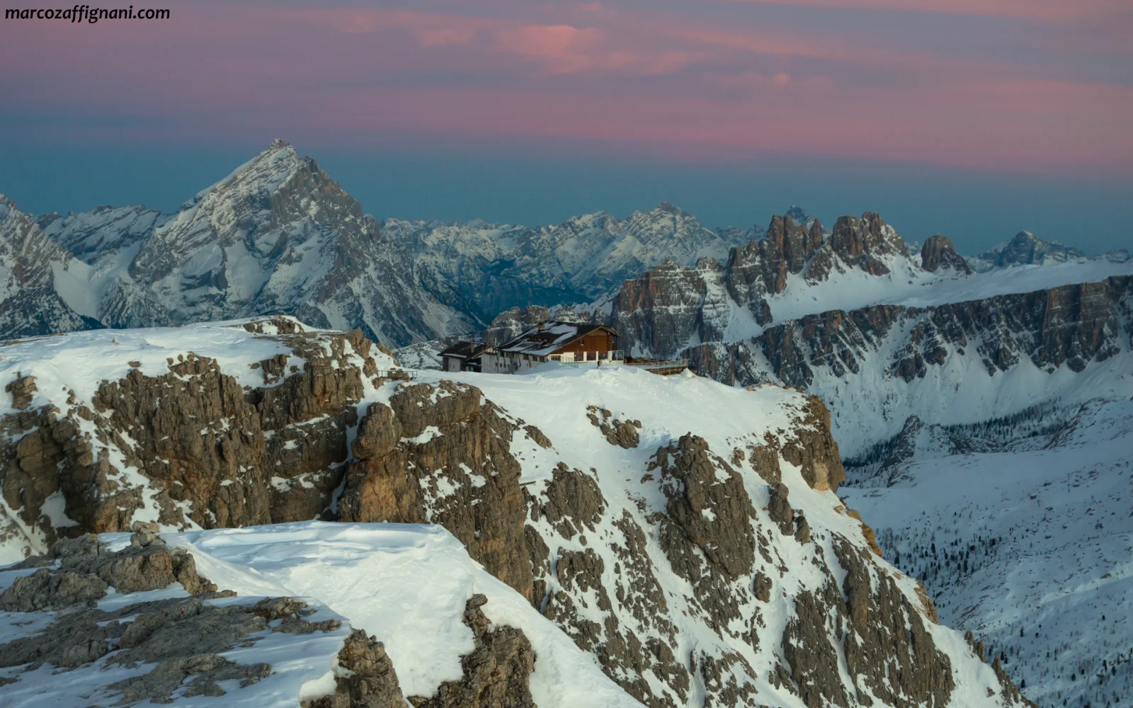
One hundred and twenty-five kilometres, twelve stages, around 7,300 m of ascent, eleven mountain groups crossed: Croda Rossa d’Ampezzo, Fanes, Tofane, Nuvolau, Croda da Lago, Pelmo, Civetta, Moiazza, Tamer-San Sebastiano, Pramper-Mezzodì and finally the Schiara. Fifteen huts, one bivouac shelter, six refreshment points. The high point is Rifugio Lagazuoi at 2,752 m.
The first half — Braies, Fanes, Lagazuoi — is the part everybody knows, and in peak season it pays the price of its own fame. We have written about that elsewhere, in The weight of too many: the problem is not how many people come, but how many arrive at the same spot on the same day.
The secret is in the second half. From Passo Duran down to Belluno the Alta Via 1 becomes a different route altogether: four stages inside the Belluno Dolomites National Park, which the Park itself describes as the least crowded section of the whole traverse. Rifugio Pramperet, Rifugio Pian de Fontana, Bivacco Marmol, and then the final 1,900 m descent down the Val d’Ardo to Case Bortot, on the edge of Belluno.

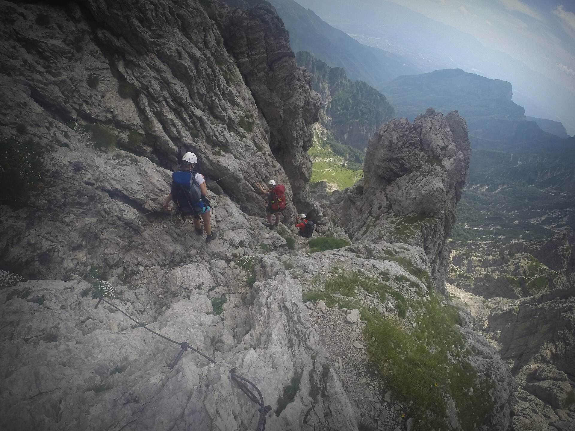
This is where the Alta Via 1 shows its teeth. The last two stages are graded EEA by the National Park, which describes them without softening anything as «extremely demanding equipped routes with exposed passages». Variants exist that avoid the cabled sections, and it is worth knowing in advance which one you intend to take. If you only want this part, a four-day Belluno Alta Via 1 from Passo Duran to Belluno is the best shortcut to Dolomite scenery without the crowds.
The final descent passes the Rifugio 7° Alpini, under the south face of the Schiara, which is also the simplest way to get to know this corner of the range without committing to the full traverse.
The other eight: how to pick yours
If you want silence: 3, 6 and 7
Alta Via 3, «of the Chamois», runs from Villabassa down to Longarone in eight stages and a hundred kilometres — enough to be a genuine alternative to number 1. The official description speaks of «silence, isolation and wild places», and the route crosses the Val Tovanella Nature Reserve, one of the least visited environments in the whole province. Take the Berti ferrata variant and you will need a via ferrata set.
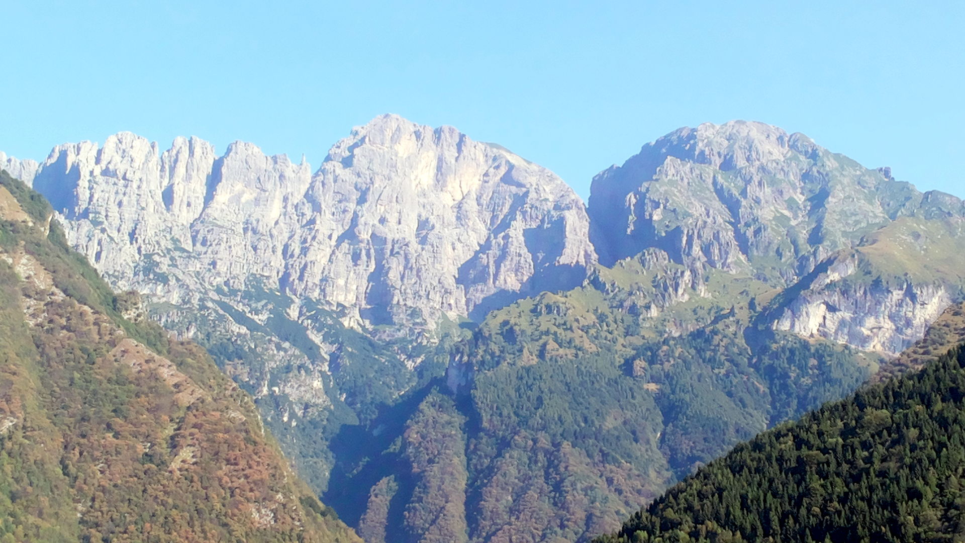
Alta Via 6, «of the Silences», keeps the promise in its name: 180 km, eleven stages and roughly 19,000 m of ascent from the source of the Piave to Vittorio Veneto, through eight groups that appear on no postcard — Cridola, Spalti di Toro, Monfalconi, Col Nudo-Cavallo. It is not a soft option, though: there are grade II and III moves. This is a step up, not a step aside.
Alta Via 7, «of Patéra», is the most Belluno of them all: thirty-six kilometres entirely inside the province, in the Col Nudo-Cavallo group above the Alpago. It is also the most severe. The official source calls it «very difficult, for expert mountaineers only», with shelter almost entirely in unstaffed bivouac huts. No queues, no bookings, no comfort.
If you carry a via ferrata set: 4 and 5
Number 4, «of Grohmann» (85 km, 6 stages, San Candido to Pieve di Cadore) and number 5, «of Titian» (90 km, 7 stages, Sesto to Pieve di Cadore) have cabled sections throughout: here a via ferrata set is not an optional extra, it is the condition of setting out. Many of those ladders and cables descend from military works of 1915-1916, and that is a piece of history you walk with your feet. Number 5 includes the Sentiero degli Alpini and the Strada Sanmarchi; number 4 is named for Paul Grohmann, co-founder of the Austrian Alpine Club and first ascensionist of many Dolomite summits.
If you are short of days: 8, and the Alta Via Dolomiti Bellunesi
Alta Via 8, «of the Heroes», runs from Feltre to Bassano del Grappa in four technically straightforward stages and 63 km. The difficulty here is of a different kind: very few places to stay and very little water. It is a First World War route, ending at the 1935 Monte Grappa memorial.
There is also a route outside the numbering that deserves to be better known: the Alta Via Dolomiti Bellunesi, six stages from Forno di Zoldo to Feltre, entirely within the National Park. Roughly half of it follows numbers 1 and 2; the rest uses lightly waymarked paths, some of them in strict nature reserve, and calls for navigation as well as legs.

That leaves number 2, «of the Legends»: 180 km and thirteen stages from Bressanone to Feltre, with 11,500 m of ascent, eight groups and thirty passes and cols. It touches Piz Boè at 3,152 m, follows the Viel del Pan — the old bread road between Val di Fassa and the Agordino — and finishes in the Vette Feltrine at Rifugio Dal Piaz and Rifugio Boz. Three variants exist for getting around the Marmolada.
E, EE, EEA: what the grades really mean
These are the Italian Alpine Club grades, and they are not decorative. Misreading them is the commonest way to get into trouble here.
- T — Tourist. Obvious tracks and mule paths, gentle gradients, no navigation problems.
- E — Hiking. Paths and traces, with possible easy, unexposed rock steps. Needs navigation sense and fitness.
- EE — Experienced hikers. Rough or treacherous ground: steep grass, rock steps, scree, exposed sections, traverses and ledges. Sure-footedness and a head for heights required. It does not include via ferrata.
- EEA — Experienced hikers with equipment. Via ferrata with cables, ladders and rungs. Here the kit is compulsory.
For EEA sections you need a harness, helmet, a via ferrata set with energy absorber certified to CE EN 958, gloves and stiff boots. Above all you need hands that know what to do: your first via ferrata should not be on an Alta Via — learn it beforehand, ideally with an instructor.
Sleeping in the huts: costs and booking
The Italian Alpine Club publishes a maximum tariff each year for the huts it owns. For 2026 (CAI circular no. 15/2025, 15 October 2025) bed-only rates run from €30.00 for non-members in category A/B huts to €39.00 in category E. CAI members get a guaranteed minimum 20% discount on half board, rising to 30% for under-25s. Reciprocal-rights members of partner alpine clubs — including the UK, Austrian and German clubs — should ask their own club which rate applies.
Three rules worth knowing before you go:
- A personal sleeping-bag liner is compulsory for overnight stays. This is not advice, it is written into the circular.
- Bed-only stays are limited to three consecutive nights.
- Eating your own food costs €3 for non-members and is free for members.
One common misunderstanding: these caps apply to huts owned by CAI. Many huts on the Alte Vie — Nuvolau, Città di Fiume and Lagazuoi among them — are privately run and set their own prices. Ask each one directly.
There is an official CAI booking platform, prenotarifugi.cai.it, which lets you search by region and book several consecutive huts along one route, including a number of private ones. In high season booking is effectively essential, and many wardens open the following summer as early as winter. Strictly speaking it is not a legal requirement, though: it is a rule set by individual wardens.
Getting there without a car (and for Lago di Braies it genuinely pays)
An Alta Via is one of the few mountain trips where a car is a liability: you start in one place and finish in another, days apart. The train solves the problem at the root.
The Padua – Montebelluna – Feltre – Belluno – Ponte nelle Alpi – Calalzo line serves every Belluno trailhead: Feltre for numbers 2 and 8, Belluno for the end of number 1, Longarone for number 3, Calalzo for numbers 4 and 5. Bressanone, Villabassa, San Candido and Sesto — the northern starts — sit on the Val Pusteria railway, changing at Fortezza. From Calalzo and Belluno, Dolomitibus services reach the valleys: line 9 links Belluno to Calalzo along the Piave, line 30 runs from Calalzo to Cortina, line 17 connects Feltre and Belluno.
One practical warning: the Ponte nelle Alpi – Calalzo section has repeatedly been closed for upgrade works with replacement buses. Check before you travel.
For Lago di Braies, the start of number 1, the rules have changed. From 1 July to 15 September, private cars may enter the valley between 09:00 and 16:00 only with an online booking or transit permit, and even the 442 and 439 bus services must be booked online. Arrive by public transport and the restrictions do not apply to you. From 16 September only line 442 runs, with tickets bought on board.
If that side of things interests you beyond the Alte Vie, we go into it at length in The Dolomites without overtourism.
Safety: the number to call
This is the most important paragraph on this page, and the one people most often get wrong.
In the province of Belluno, and across the Veneto, mountain rescue lists one number only: 118. It is set out in capitals on the CNSAS Veneto website; the service operates 24 hours a day, all year, with around 769 rescuers. The European emergency number 112 is not yet fully operational in the Veneto: the region approved its governance model by resolution published in December 2025, but rollout is still under way.
In the autonomous provinces of Trento and Bolzano, 112 is the number, and it is fully live. On the Alte Vie this matters in practice: the South Tyrolean stages of numbers 1, 2, 3, 4 and 5 fall under 112; from Cortina southwards you are in the province of Belluno and 118 is the direct line to mountain rescue. In any case 112 always works, on any GSM network: if in doubt, call it and you will be put through.
Before you book: 2026 updates
Mountains change, and the summer of 2026 changed a good deal. On 11 August 2026 a further rockfall hit the north-west face of Monte Pelmo, in the municipality of Borca di Cadore; municipal ordinance no. 16 of 10 August 2026 closed the paths on that side «until further notice». It is not publicly documented whether, or how far, this affects the Alta Via 1 between Rifugio Città di Fiume and Rifugio Venezia: before planning those stages, ask the Comune di Borca di Cadore, the Belluno Dolomites National Park or DMO Dolomiti directly.
Which is the most useful advice we can give, and it holds every year: the most current conditions report is always the hut warden’s. One phone call before you leave is worth ten guidebooks.
Frequently asked questions
How many days does the Alta Via 1 take?
Twelve stages officially, but most walkers complete it in seven to ten days by combining some of them. The «Belluno» version, from Passo Duran to Belluno, takes four days.
When is the season?
Broadly late June to late September, while the huts are open. Sources vary between mid and late September, depending on the year and the snow. September, if the weather holds, is the best month: fewer people, clearer air, larches beginning to turn.
Can I walk an Alta Via with no via ferrata experience?
Yes. Number 1 with the variants that avoid the cabled sections, number 8 and number 9 need no kit. Numbers 4 and 5 do, and that is not negotiable.
Are the routes waymarked?
Yes, with the red-and-white CAI waymarks and the Alta Via number inside a triangle. On the Alta Via Dolomiti Bellunesi and on parts of numbers 6 and 7 the waymarking thins out: there you need a map, a compass and a clear head.
Do I need to be a CAI member?
No, but it pays. A minimum 20% discount on half board, multiplied by ten nights, more than covers the membership.
A different way of looking at these mountains
Sixty years ago, in a club room in Belluno, someone had the idea that you could cross the Dolomites from north to south without ever dropping to the valley. Since then the Alta Via 1 has brought hundreds of thousands of people up here, and has ended up a victim of its own success along the first half of the route.
The good news is that the other eight are still there — and that the second half of number 1, the Belluno half, the National Park half, the one that ends beneath the Schiara, is very much as it was. You just have to choose.
Keep exploring
- All the Alte Vie, route by route
- Rifugio 7° Alpini, beneath the south face of the Schiara
- The Belluno Dolomites National Park
- The Dolomites without overtourism: the quieter places
- The Belluno Dolomites: what to see
- A history of the Belluno Dolomites
Cover image: Monte Civetta above the basin of Rifugio Coldai, on the Alta Via 1. Photo: Marco Pestarino, Wikimedia Commons, CC BY-SA 4.0.