

It is the only national park lying entirely within the Veneto, it sits wholly inside the province of Belluno, and a great many people drive through it without realising they are in it. Thirty-one thousand hectares between the Cismon and the Piave, fifteen municipalities, a quarter of Italy’s flora packed into one handkerchief of mountains. And no queues, no daily cap, no booking.
The Belluno Dolomites National Park is the most direct answer to the question a growing number of visitors are asking: where are the Dolomites that are not on Instagram. This guide is here so you arrive knowing what you are walking into — which valleys are half an hour by car from Belluno, which paths work with children and which do not, what the regulations actually say, and when to come.
What it is, and what it is not
First, a distinction that trips up plenty of people. The National Park and the UNESCO «Dolomites» World Heritage site are two different things. The first is an Italian protected area with a managing authority, a set of regulations and its own rangers; the second is a serial natural property on the World Heritage List, divided into systems. Most of the Park falls within System 3, «Pale di San Martino, San Lucano, Dolomiti Bellunesi and Vette Feltrine», which covers 31,666 hectares across the provinces of Belluno and Trento and also takes in groups that are not in the Park, such as the Civetta and the Moiazza.
The Park was established by ministerial decree on 20 April 1990; the managing authority followed with the presidential decree of 12 July 1993, and the present boundary with that of 9 January 2008. Sixteen thousand of its hectares were already protected as state nature reserves.
The numbers
The Park Authority says «a little over 31,000 hectares»; Italy’s official register of protected areas gives 31,512. The difference is marginal, but worth knowing, because both figures circulate.
- 15 municipalities, all in the province of Belluno: Belluno, Cesiomaggiore, Feltre, Gosaldo, La Valle Agordina, Longarone, Pedavena, Ponte nelle Alpi, Rivamonte Agordino, San Gregorio nelle Alpi, Santa Giustina, Sedico, Sospirolo, Sovramonte and Val di Zoldo.
- From 412 to 2,565 metres. The highest summit is the Schiara at 2,565 m, followed by Sass de Mura at 2,550 m and Talvéna at 2,542 m.
- Around 60% is forest, 27% bare rock, 12% meadow and pasture, 1% water.
- Over 200 km of CAI paths, across 52 numbered routes and 5 via ferratas.
- The Park Authority is based in Feltre, Piazzale Zancanaro 1, tel. +39 0439 3328.
The mountain groups are the Vette Feltrine, Cimonega, Brendol, Monte Pizzocco, Monti del Sole, Schiara, Prampèr and Talvéna, held together by two ridges: the Alpi Feltrine to the west and the Schiara-Talvéna chain to the east.
Val del Mis: the easiest way in
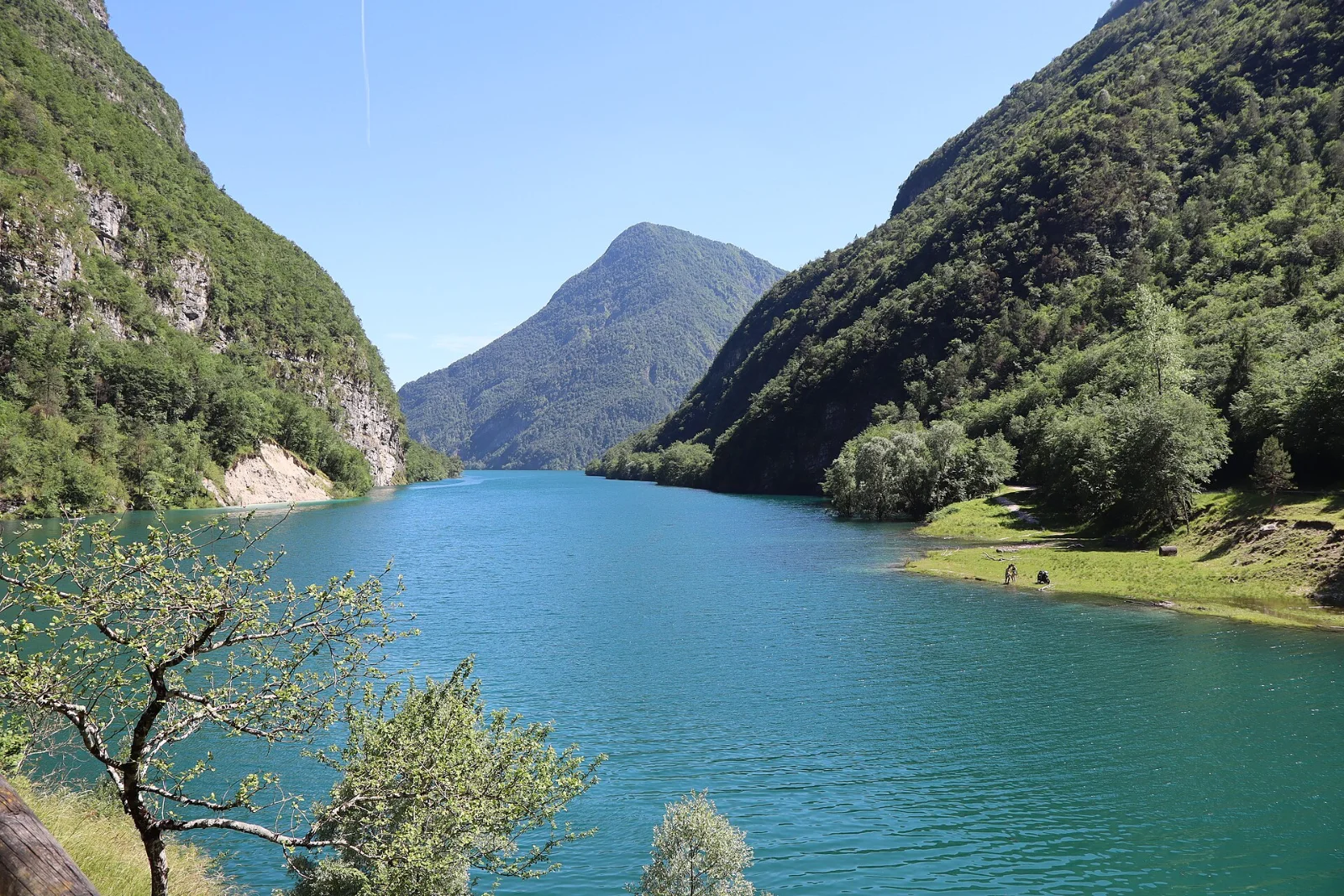
If you have one day and want to understand what this place is, go to the Val del Mis, above Sospirolo. It is an old fluvio-karstic canyon followed by provincial road SP 2, which climbs from Pian Falcina and Lake Mis up to La Stua: you drive inside the Park and stop wherever you like. The Authority itself rates the route as easy.
The Cadini del Brenton
Fifteen potholes carved into the Dolomia Principale by the Brentòn torrent: green pools set in the rock, on the right-hand side of the valley just upstream of the lake. The walk is one kilometre, thirty minutes, graded T, at 433 m. Anyone can do it. The Park recommends March to November.
One rule broken here constantly: swimming and sunbathing at the Cadini are forbidden, and you must stay on the path. It is not fussiness — these are deep potholes with freezing water and polished sides, and the rock around them is fragile.
The Soffia waterfall
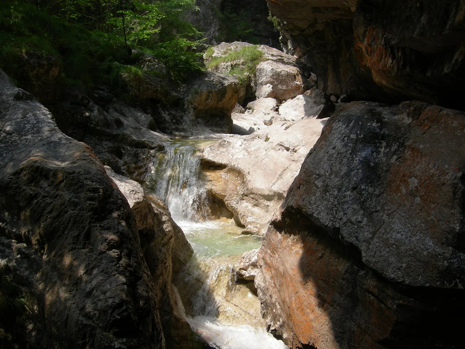
A little further along the same road, a short detour leads to the Cascata della Soffia, a fall in a gorge setting beneath the Monti del Sole. It is one of the most photographed spots in the Park and one of the few places where you can see and hear the water up close without hours of walking.
Val Falcina
A 4 km loop, two hours, graded T, between 420 and 660 m, starting from the car park at Pian della Falcina. Seven interpretive panels along the way cover the woodland, the water and the wildlife: it is the best nature trail for a first visit, and one of the places where the Park reports golden eagle.
Val Canzoi and Lake Stua
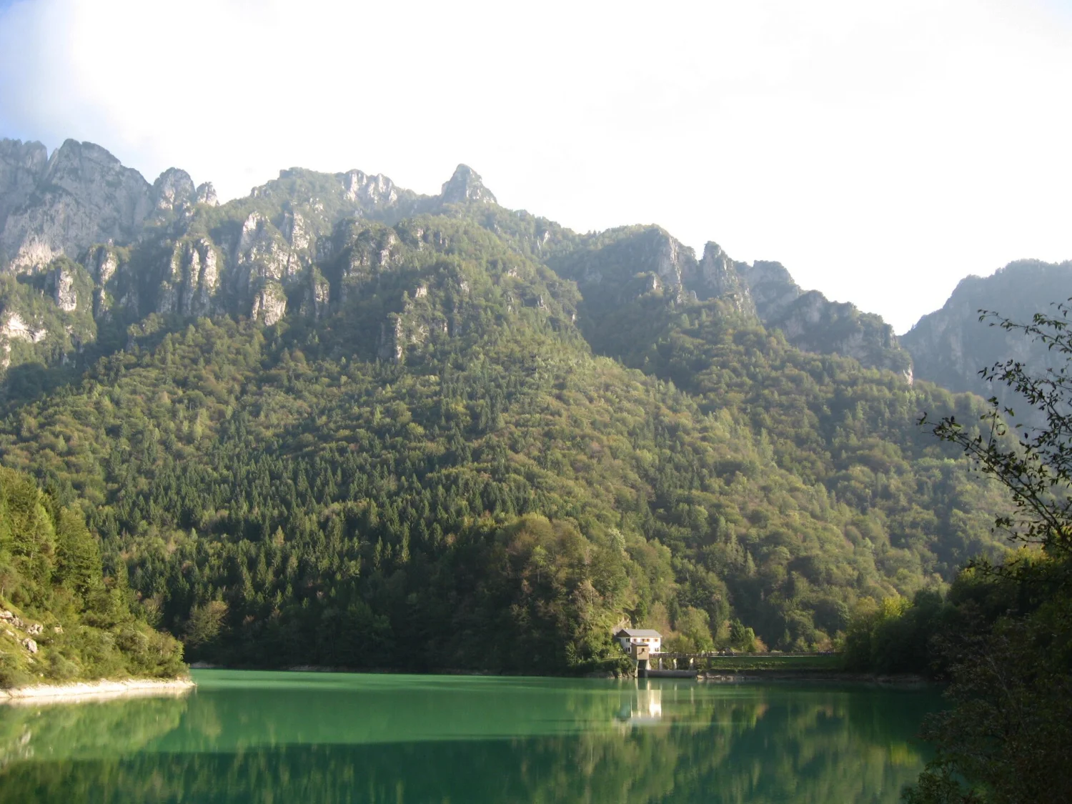
On the Feltre side, Val Canzoi follows the Caorame torrent up to Lake Stua. The nature loop around the lake starts at Preton, where the car park is: 8.4 km, four hours, path CAI 806, walkable from March to October.
A note in the interest of honesty: the Park’s own pages grade this loop two different ways, T on the index page and E on the detail sheet. Plan for the second — four hours with height gain is not a stroll.
Val Canzoi also holds the Park’s environmental education centre at La Santina, with laboratories, microscopes, aquaria and an information point.
The «Campanula morettiana» botanical garden

It sits in Val Brenton, next to the Cadini, and takes its name from Campanula morettiana, the violet-flowered Dolomite endemic that is the Park’s emblem species. It holds more than 1,500 species across five reconstructed habitats: alpine cliffs, wetlands, meadows, pastures and woodland. It is wheelchair accessible, with Braille signage and tactile maps.
Practical details for 2026: admission € 4, free for under-12s, over-65s, disabled visitors, pregnant women and residents of the Park’s fifteen municipalities. Opening: June, Saturday and Sunday 9.30-17.30; July, Friday to Monday 9.30-17.30; August, daily 9.30-17.30; September, Saturday and Sunday 10.00-17.00. Outside staffed hours entry is free. Guided visits on Sundays in July and every day in August at 10, 11, 12, 14.30 and 15.30, run by the ISOIPSE association (tel. +39 320 196 3266).
The paths, from stroll to via ferrata
The network has 52 numbered CAI paths — the 500 series on the Schiara and Cordevole side, the 800 series on the Feltre side — and five via ferratas: Berti, Zacchi (503), Del Marmol (514), Sperti (504) and Marino Guardiano al Pelf. Here are the routes with an official Park sheet, easiest first.
| Route | CAI | Start | Data | Grade |
|---|---|---|---|---|
| Cadini del Brenton | — | Val del Mis, 433 m | 1 km · 30 min | T |
| Val Falcina loop | — | Pian della Falcina, 748 m | 4 km · 2 h · 420-660 m | T |
| Buss del Buson loop | — | Case Bortot (Belluno), 650 m | 1.5 km · 1h30 · +150 m | E |
| Lake Stua loop | 806 | Preton, Val Canzoi | 8.4 km · 4 h | E |
| Rifugio Bianchet | 530 | La Pissa, Val Cordevole, 449 m | +800 m · 2h30-3 h | E |
| Rifugio 7° Alpini | 501 | Case Bortot, 694 m | +800 m · 3 h | E |
| Rifugio Dal Piaz and Busa delle Vette | 801 | Passo Croce d’Aune, 1,015 m | +980 m · 3 h | E |
| The Vette cirques | 801 and traces | Rifugio Dal Piaz | 13.5 km · 6 h | EE |
| Piazza del Diavolo strict reserve | 801 / Alta Via 1 | Croce d’Aune, 1,015 m | +1,300 m · 2 days | EE |
| Schiara via ferratas | 503 · 504 · 514 | Rifugio 7° Alpini | full kit required | EEA |
The Buss del Buson, above Case Bortot, deserves its own line: a fossil canyon with fossils visible in the rock, which the Park describes as a «stone auditorium» — concerts are held there. It is an hour and a half from the city of Belluno, there and back.
The best-known hut in the Park is the Rifugio 7° Alpini, under the south face of the Schiara, and the via ferratas start from it. The Park is also crossed by Alta Via 1 and Alta Via 2: the final four stages of number 1, from Passo Duran down to Belluno, are the least crowded section of that whole traverse.
The Piani Eterni, and why you cannot drive there
Above Val Canzoi lies the karst plateau of Erera-Brendol and the Piani Eterni: dolines, limestone pavement, karren, and beneath it a cave system whose deepest shaft comes close to a thousand metres. It is one of the most surprising landscapes in the entire Alps, and there is no road: you walk up from Lake Stua on mule track 802, with around a thousand metres of ascent. The Authority calls it, without softening it, a demanding route.
The Piani Eterni lie in Zone A, strict nature reserve, along with the Vette Feltrine, Caserin in the Cimonega, Monte Brendol and the Talvéna — some 2,500 hectares in all. One rule applies without exception: you may not leave the path.
The Certosa di Vedana
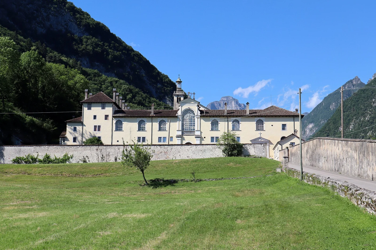
The Park Authority calls it «the most important historic and architectural feature of the Park». Founded in 1456, suppressed in 1768 and turned into a farm, it was rebuilt and enlarged after 1882 to a design by the architect François Pichat. Since 1977 it has housed a community of enclosed nuns: the complex is admired from outside and from its avenue, and any visit to the monastic buildings has to be arranged directly, because the enclosure is active.
The themed path «La Via degli ospizi» leads here, linking the Certosa to the Valle Imperina — the Park’s other great memory, that of the copper mines.
What lives here
The Park has recorded 204 vertebrate species: 7 bony fish, 12 amphibians, 13 reptiles, 140 birds and 32 mammals. For the big numbers: over 3,000 chamois and more than 2,000 roe deer. There are around a hundred species of butterfly and, in the karst caves, endemics found nowhere else. Lynx and bear have returned on their own.
The species that worries is the capercaillie: the Park calls it «rather rare», concentrated in the north-eastern sector — Caiada, Val Vescovà, Valle Imperina — and in worrying decline, with few lek sites still regularly used. Display runs from late March to late May, which is exactly when it must not be disturbed.
On the botanical side the figures are more striking still: about 1,400 vascular species, a quarter of the flora of the whole of Italy. The reason is geological — the southern sector escaped the glaciations and preserved very old species. Alyssum oxycarpa and Delphinium alpinum grow in the Busa delle Vette. And the Codex Bellunensis, a fifteenth-century illustrated herbal of plants gathered on these very mountains, is now in the British Library.
The rules, in short
The Park regulations were published in the Official Gazette on 9 July 2021 and took effect on 7 October that year. The provisions that most often catch out visitors:
- No daily cap and no booking to enter the Park. There is no entrance ticket: the only paid admission is the botanical garden.
- Dogs: always on the lead, and not allowed in Zone A strict reserves.
- Drones: overflight is prohibited. They are permitted only for scientific research and wildlife management, with prior clearance. Recreational flying, therefore, no.
- Bikes and MTB: on regional, provincial and municipal roads; on forest tracks only in zones C and D; in zone B only on the routes shown in the Plan mapping.
- Mushrooms: wild epigeous species only, only in zones C and D, maximum 3 kg per person per day, with the regional permit. Rakes, hooks and plastic containers are banned. Truffle collecting is prohibited throughout the Park.
- Wild camping and bivouacking: prohibited. Camping is allowed only in equipped areas.
- Fires: prohibited all year round, except in the fixed grills of equipped areas.
- Swimming: prohibited in zones A and B2 and in the Cadini del Brenton area. Canyoning: prohibited.
- Off-roading: prohibited; forest tracks are closed to motor vehicles other than those of rights holders.
Getting there
By train, the Padua-Montebelluna-Feltre-Belluno-Calalzo line serves every entrance: the reference stations named by the Authority are Feltre, Belluno and Ponte nelle Alpi, and bikes are carried. It is the option we recommend, for the reasons set out in The Dolomites without overtourism.
By car: A27 motorway, Pian di Vedòia exit; A31, Dueville exit; the SS 47 through the Valsugana; the SS 51 from Cortina. Inside the Park the two drivable roads are the SP 2 through the Val del Mis and the SR 203 Agordina along the lower Val Cordevole; every other access road is restricted.
Car parks: Pian Falcina in the Val del Mis, the largest, with a hundred car spaces, two coach bays and twelve motorhome pitches; Passo Croce d’Aune for the Vette Feltrine; Preton in Val Canzoi; Case Bortot above Belluno; La Pissa in Val Cordevole; Candaten at Sedico, which also has a picnic area on the Cordevole.
By bus: regional services are run by Dolomitibus (+39 0437 217111). Be careful, though: the summer tourist lines advertised for 2026 serve Cortina, the Falzarego, the Giau and the Marmolada — not the National Park. For the Val del Mis and Val Canzoi, check the ordinary line timetables before you travel.
When to come
The Park does not publish a single seasonal calendar: the recommended periods sit in the individual route sheets, and they are these.
- Cadini del Brenton and Val del Mis: March to November. This is the part of the Park with the longest season.
- Val Canzoi and Lake Stua: March to October.
- Vette Feltrine and Rifugio Dal Piaz: May to October.
- The Vette cirques and Buss del Buson: May to September.
- Botanical garden: open June to September.
September and October are the best months for the Val del Mis: the water is high, the beeches turn, and the pools of the Cadini take on a green they do not have in summer. Late March and April are capercaillie display season — wonderful to know about, and a bad time to go looking.
Frequently asked questions
Do I need a ticket to enter the Park?
No. Access is free and there is no entrance charge of any kind. The only paid admission is the «Campanula morettiana» botanical garden, € 4, and only during staffed hours.
Is it suitable for children?
Yes, and there are routes designed for it. The Cadini del Brenton are thirty flat minutes; the Val Falcina is a two-hour loop with interpretive panels; the «Two steps from the Park’s doors» series collects seven walks from half an hour to two hours, all graded T.
Can I bring my dog?
Yes, always on the lead, but not into Zone A strict reserves — so not to the Piani Eterni or the Busa delle Vette.
Can you swim in the Cadini del Brenton?
No. Swimming is expressly forbidden there by the regulations, as it is in zones A and B2.
How many days do I need?
One day covers the Val del Mis with the Cadini, the Soffia and the Val Falcina. Two days adds Val Canzoi or the climb to Rifugio Dal Piaz. The Piani Eterni and the Vette need a full weekend and fit legs.
The park you were not expecting
One figure says it all: a quarter of Italy’s flora in thirty-one thousand hectares. The Belluno Dolomites National Park has no postcard summit everyone recognises, no cable car and no queue. What it has is fifteen towns living inside it, a canyon you can drive through, fifteen green pools half an hour from the car, and a karst plateau that asks a thousand metres of ascent in return.
It is exactly the kind of place sought by people who read The weight of too many and decided to go somewhere else.
Keep exploring
- The Belluno Dolomites National Park in brief
- The Alta Via trails: which one to walk
- Rifugio 7° Alpini, beneath the Schiara
- The lakes of the Belluno Dolomites
- The Dolomites without overtourism: the quieter places
- The Belluno Dolomites: what to see
Cover image: the Cadini del Brenton, in the Val del Mis. Photo: Syrio, Wikimedia Commons, CC BY-SA 4.0.